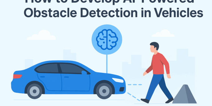
Obstacle detection is the critical sensor-perception system that tells a vehicle “what’s in front of me, where it is, how fast it’s moving, and whether I need to stop or steer.” Building a reliable AI-powered obstacle detection system requires combining robust sensing, careful data work, efficient learning models, real-time software and hardware engineering, and rigorous testing. This guide walks you step-by-step from sensor selection through deployment and continuous improvement. The practical focus is on approaches used in modern ADAS and autonomous vehicles, including LiDAR-based 3D detectors (e.g., PointPillars), camera-based real-time detectors (YOLO family), and sensor fusion standards used in production and research. CVF Open Access+2Waymo+2
Why obstacle detection matters in modern vehicles — safety, autonomy, ADAS
At the system level, obstacle detection is a safety-critical function: missed detections or false positives both have real consequences. For assisted driving features (lane-keeping, AEB — automatic emergency braking, adaptive cruise control), the detection system feeds downstream planners and controllers that decide braking or steering interventions. In autonomy stacks, perception must provide accurate 3D localization of pedestrians, cyclists, vehicles, animals, and static obstacles, often under adverse lighting and weather. Investment here improves reaction time, reduces accidents, and enables higher levels of autonomy. Industry datasets and companies (Waymo, Tesla, Mobileye) treat perception as a core technology differentiator and continuously benchmark performance. Waymo+1
Sensor choices: cameras, LiDAR, radar, ultrasonic, thermal — tradeoffs
Choose sensors by balancing range, resolution, day/night performance, weather robustness, cost, and compute needs:
-
Cameras: High spatial resolution, cheap, great for semantic understanding (signs, lights, lane markings), but struggle in low light and poor weather.
-
LiDAR: Accurate 3D point clouds, excellent range and shape info for geometric reasoning; cost has fallen but still higher than cameras. LiDAR excels at precise localization of obstacles. PointPillars and voxel-based networks are common for LiDAR 3D detection. CVF Open Access
-
Radar: Robust in rain/fog, provides reliable radial velocity but lower spatial resolution. Radar aids long-range detection and motion cues.
-
Ultrasonic: Short-range (parking) obstacles.
-
Thermal: Useful for night pedestrian detection; often fused with other modalities.
Common production stacks fuse at least two modalities (camera + radar or camera + LiDAR) to balance coverage. Surveys emphasize multi-sensor fusion for robustness. Wiley Online Library+1
Sensing basics: timing, calibration, extrinsics & intrinsics
Accurate perception depends on precise calibration:
-
Time synchronization: All sensors must be time-stamped and synchronized (hardware or PTP/rosbag strategies) so temporal alignment prevents moving objects from appearing in different positions.
-
Intrinsic calibration: Camera lens parameters; LiDAR range calibration.
-
Extrinsic calibration: Rigid transform (rotation, translation) between sensors, typically solved with calibration targets or automated algorithms.
-
Coordinate frames: Use a consistent frame (vehicle, IMU) and maintain covariance/uncertainty for fusion.
Robust pipelines continuously validate calibration in operation and offer re-calibration steps when mechanical shocks or temperature shifts may change sensor alignment.
Datasets and benchmarks: KITTI, Waymo, nuScenes, Apollo, and synthetic data
High-quality labeled datasets are essential for training and benchmarking:
-
KITTI: Early benchmark for stereo, optical flow, and 3D detection.
-
Waymo Open Dataset: Large-scale multi-sensor dataset (high-res cameras + LiDAR), widely used for benchmarking modern detectors. Waymo provides perception and motion datasets and ongoing challenges. Waymo+1
-
nuScenes: 360° multimodal dataset with camera, LiDAR, and radar; good for fusion research.
-
Apollo / Argo: Region-specific datasets and stacks.
-
Synthetic data (CARLA, LGSVL): Useful to cover rare events and edge cases.
Use a mix of public datasets and your own fleet data; annotate with clear schema for object classes and occlusion labels.
Data collection best practices for in-vehicle systems
Collect diverse real-world data: different lighting (dawn/dusk), weather (rain, fog), urban/rural roads, different traffic densities, and rare events (animals, jaywalkers). Ensure sensor setups match production mounts, log raw sensor streams (compressed but lossless for LiDAR where possible), and include GPS/IMU for precise ground truth alignment. Maintain privacy filters (face/license plate blurring) if capturing public roads. Version and tag data by scenario type to enable targeted model training and retraining.
Data labeling: classes, 2D/3D boxes, segmentation, tracking, occlusion tags
Label strategy matters:
-
2D bounding boxes for camera tasks.
-
3D boxes for LiDAR tasks (x, y, z, w, l, h, heading).
-
Semantic segmentation for drivable space and free-space estimation.
-
Instance segmentation and tracking IDs for multi-frame tracking.
-
Occlusion / truncation flags to let models learn robustness.
Tools: CVAT, Labelbox, Scalabel, commercial annotation vendors. Keep label guidelines strict and create QA passes for label consistency.
Preprocessing: synchronization, filtering, denoising, augmentation
Key preprocessing steps:
-
Temporal alignment with timestamps.
-
Point cloud filtering (ground removal, ROI clipping).
-
Image noise reduction and color correction.
-
Data augmentation: geometric transforms, photometric variations, point-dropout for LiDAR, sensor failure simulation.
-
Domain randomization for synthetic-to-real transfer.
Augmentation improves generalization and helps models handle domain shifts.
Classical computer-vision baseline approaches
Before deep models, classical pipelines provided solid baselines:
-
Background subtraction / optical flow for moving obstacle detection.
-
Stereo depth estimation and clustering for 3D obstacle candidates.
-
Geometric sensors: occupancy grid mapping from LiDAR.
Use classical methods for lightweight fallback systems or to bootstrap training data (auto-labeling).
Deep learning for 2D detection: YOLO family, Faster R-CNN, SSD
For camera-based detection:
-
YOLO variants (YOLOv5/v8) and SSD excel at real-time inference with moderate accuracy.
-
Faster R-CNN gives higher accuracy at cost of latency — useful in non-hard-real-time backends.
-
Use tracking (DeepSORT, ByteTrack) to add temporal consistency and reduce false positives. Real-time vehicle systems often adopt a lightweight YOLO-toned model and enhance with temporal smoothing to meet latency budgets. MDPI
3D LiDAR detection: voxel, point-based, and PointPillars approaches
LiDAR 3D detectors fall into families:
-
Voxel-based (VoxelNet, SECOND) voxelize space and apply 3D convs.
-
Point-based (PointNet/PointNet++) operate directly on points.
-
Hybrid/point-voxel methods combine both.
-
PointPillars: lightweight, fast encoder that creates vertical “pillars” and applies 2D convolutions for speed — widely used in real-time systems due to an excellent speed/accuracy tradeoff. CVF Open Access+1
Sensor fusion strategies: early, mid, late fusion; geometric alignment
Fusion can occur at:
-
Early (raw data): project LiDAR points into image space and feed combined representations to a model.
-
Mid-level: extract features per sensor and fuse feature maps (popular for cross-modal learning).
-
Late fusion: fuse detection outputs (e.g., combine camera detections with LiDAR clusters).
Choose based on compute and calibration accuracy. Mid-level fusion often balances robustness vs. complexity.
Multimodal architectures: camera+LiDAR+radar fusion examples
State-of-the-art architectures integrate velocity cues (radar), shape (LiDAR), and semantic understanding (camera). Examples include:
-
LiDAR backbone (PointPillars) + camera ROI pooling for classification & attributes.
-
Learned attention modules to weigh modalities per scenario.
Research continues to show radar-camera fusion is promising for robust tracking under adverse conditions. arXiv
Real-time constraints: latency, throughput, fixed-point inference
Real-time perception must meet hard deadlines (e.g., 50–100 ms end-to-end). Mitigations:
-
Use efficient backbones (MobileNet, EfficientNet-lite).
-
Batch size = 1 streaming inference; use pipelined threads for sensor I/O, preproc, inference, and postproc.
-
Optimize I/O and avoid unnecessary copies.
-
Use fixed-point inference (INT8) where safe; validate accuracy drop.
Embedded hardware options: Jetson, Xavier, Drive Orin, TPUs
Hardware choices depend on power, thermal, and compute budget:
-
NVIDIA Jetson family (Orin, Xavier, Jetson AGX, Jetson Thor) supports robotics and perception stacks with TensorRT acceleration. NVIDIA provides SDKs and a JetPack toolchain for deployment. NVIDIA
-
Automotive-grade SoCs (NVIDIA Drive Orin/Thor, Qualcomm automotive platforms).
-
Edge TPUs / Coral for lightweight CNNs.
Select hardware aligned with latency and model complexity requirements.
Model compression and optimization: quantization, pruning, TensorRT
To meet real-time constraints:
-
Quantize to INT8 or FP16 (use calibration datasets to limit accuracy loss).
-
Prune redundant channels/filters.
-
Convert to optimized runtime (TensorRT, ONNX Runtime, OpenVINO).
Measure end-to-end latency and accuracy; run hardware-in-the-loop tests.
Perception pipelines: detection → tracking → behavior prediction
Full-stack perception:
-
Detection — find objects per frame.
-
Tracking — assign consistent IDs and estimate velocities.
-
Prediction — forecast short-term trajectories.
-
Planning — determine safe maneuvers.
Each stage communicates uncertainty (covariances) to the next; this is essential for safe decision-making.
Testing & validation: simulation (CARLA, LGSVL), closed-course tests
Testing should combine:
-
Unit tests for modules.
-
Simulation for scalability and rare events: CARLA, LGSVL, and other simulators enable scenario replay and stress testing.
-
Closed-course testing for real-world system behavior.
-
Shadow mode ops on fleets: run perception in parallel with driver control to collect real-world edge cases without affecting safety. Autoware and other stacks allow integration into simulated and real tests. Autoware Foundation+1
Safety, redundancy & fault tolerance: graceful degradation
Design for failures:
-
Multi-sensor redundancy so a camera or LiDAR failure doesn’t catastrophically remove perception.
-
Health monitoring: check sensor and model outputs for anomalies.
-
Fail-safe behaviors: slow down, pull over, or alert human operator if perception confidence drops below thresholds.
Regulatory & ethical considerations: privacy, data governance
Be mindful of:
-
Privacy: store minimal PII, blur faces/license plates when required, comply with local privacy laws.
-
Data governance: consent and retention policies for collected logs.
-
Standards: functional safety (ISO 26262), safety of intended functionality (SOTIF ISO 21448), and automotive cybersecurity standards. Consider legal and liability implications of perception failures.
Explainability & debugging: visualization, saliency, uncertainty
Practical tools:
-
Visualize predicted bounding boxes, point clouds, and attention maps.
-
Log model confidences and uncertainties; use Bayesian or ensemble methods for calibrated uncertainty.
-
Saliency and Grad-CAM help explain model decisions for debugging and regulatory audits.
Continuous learning and data pipelines for updates
A production perception stack includes:
-
Data pipelines: ingest telemetry, auto-label high-confidence samples, human-in-the-loop annotation for edge cases.
-
CI/CD for model updates, with A/B testing and shadow deployment.
-
Monitoring to detect distribution drift and trigger retraining.
Open-source stacks: Autoware, Apollo, ROS2 and production examples
Open-source platforms accelerate development:
-
Autoware: perception, planning, control modules tailored to autonomy; includes obstacle planners and modules for detection/avoidance. Autoware Foundation
-
Apollo: Baidu’s open AD stack with perception modules.
-
ROS2: middleware supporting modular nodes and sensor integration.
These stacks are useful for prototyping and as references for production architectures.
Business considerations: cost, supplier choices, maintenance
Decide on trade-offs:
-
LiDAR gives accuracy at cost; some OEMs opt for camera + radar stacks for cost reasons.
-
Maintenance costs: sensor calibration, hardware refresh cycles.
-
Supplier ecosystem and long-term availability for parts.
Roadmap & practical checklist — from prototype to production
Practical checklist:
-
Choose sensors for your use-case.
-
Instrument a data collection vehicle and collect diverse scenario data.
-
Build a labeling & QA pipeline.
-
Prototype models on public datasets (KITTI, Waymo, nuScenes).
-
Integrate into a perception pipeline with tracking and uncertainty outputs.
-
Optimize for target hardware (quantize, TensorRT).
-
Validate in sim and closed course; deploy in shadow mode.
-
Implement safety monitoring and update pipelines.
Frequently Asked Questions
What is the simplest sensor setup to prototype obstacle detection?
Start with a stereo camera rig and a single roof-mounted LiDAR (if budget permits). Cameras allow quick semantic detection; a single 16–32 channel LiDAR helps with 3D localization.
Which dataset should I start training on?
If you have cameras + LiDAR, Waymo Open Dataset and nuScenes are excellent. For quick prototyping, KITTI provides smaller-scale tasks. Waymo+1
Is LiDAR required for reliable obstacle detection?
Not strictly—camera-only systems can detect many obstacles with deep networks, but LiDAR provides reliable 3D localization and excels in difficult lighting. Many production systems fuse sensors for best reliability.
How do I ensure my system works at night and in rain?
Fuse radar and thermal sensors for poor-visibility robustness, augment training data with simulated rain/fog, and validate in real adverse conditions.
What are good real-time models for embedded platforms?
Mobile-friendly backbones with YOLO variants for vision; PointPillars for LiDAR; optimize with INT8 quantization and TensorRT on NVIDIA Jetson devices. CVF Open Access+1
How to measure safety readiness?
Use defined KPIs: detection recall at strict distances, false positive rate, latency, and confidence calibration. Conduct scenario-based testing, including rare events and edge cases.
Conclusion
Developing AI-powered obstacle detection for vehicles is a multidisciplinary engineering effort: choose the right sensors, assemble high-quality labeled datasets, select models that meet your accuracy and latency targets, and deploy them on hardware engineered for real-time inference. Prioritize redundancy, continuous data collection, thorough testing in simulation and real environments, and clear safety/monitoring mechanisms. By following a structured roadmap — data → model → optimization → validation → continuous improvement — teams can deliver robust perception systems that significantly improve vehicle safety and enable advanced autonomy. For further reading, check the PointPillars paper for LiDAR 3D detection and the Waymo Open Dataset for large-scale perception training; also explore NVIDIA’s Jetson ecosystem for production edge hardware. CVF Open Access+2Waymo+2